City Hall is located in Via Guglielmo Marconi 34,
Population: The municipality of Pianopoli had a population of 2.215 inhabitants accordingly to the results of the national census made in 2001.
The inhabitants are distributed in 846 families with an average of 2,74 people per family.
The place: The territory of the municipality lies between 62 and 600 metres above sea level. The altimetric spawn is thus of 538 metres.
Work and workers:There are 56 industrial firms employing 367 people that are the 50,34% of the total of the workers. There are 59 service firms employing 113 people that are the 15,50% of the total of the workers.
There are 60 firms employing 180 people that are the 24,69% of the total of the workers.
There are 17 administrative offices employing 69 workers that are the 9,47% of the total of the workers.
There is a total of 729 workers, that are the 31,49% of the inhabitants of the municipality.


Santa Croce Church (The first Church built)

Corso Roma, the main street of Pianopoli during feast day

Palazzo Torchia
 Palazzo Torchia (Santa Croce)
 Arco del Palazzo Torchia visto dall'interno (Arch of old Torchia's building-inside view)
Pianopoli view

Corso Roma- Pianopoli main road during feast day

Panoramic view

Panoramic of Pianopoli

Mountain view looking towards Pianopoli and surrounding

View of Pianopoli

Pianopoli soccer field (foto by comune di Pianopoli)
.jpg)

Corso Roma looking from Santa Croce area

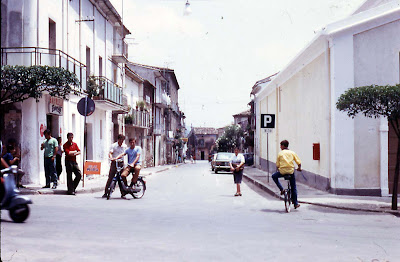
Corso roma looking from south towards Santa Croce (1970's)

Corso Roma before it was (prolonged) extrended - foto 1968 by G.Faga

Via XX Settembre - view of Palazzo Pugliese (1970's)

Corso Roma before it was (prolonged) extrended - foto 1968 by G.Faga

Via XX Settembre - view of Palazzo Pugliese (1970's)

Via Addolorata

Via Indipendenza (called U' Fuessu)

Via Umberto I (via San'Antueni)

Corso roma 2008

Corso Roma 2008
.JPG)
Corso Roma at sunset 2008

Corso Roma by night (2008)

Largo San Antonio

Palazzo Municipale- Municipal Town Hall
 Santuary of Madonna Addolorata
 Church Tower
house restored to origin (Todaro's house)

Saint Thomas Church (town protector)
Via Guglielmo Marconi (via del Municipio) 1970's
 view of Santa Croce Church

Via Guglielmo Marconi (via del Municipio) 1970's
 view of Santa Croce Church
 Town Monument of WWI Veterans
Pianopoli è una cittadina situata su di un altipiano a metri 250 s.l.m., con alle spalle le montagne che raggiungono l'altezza di metri 1198 con il monte Contrò, dalle quali si gode un panorama stupendo della fertile Piana di S. Eufemia e del Golfo omonimo, nonchè dei centri abitati di Lamezia Terme, Feroleto Antico, S. Pietro a Maida, Maida, lacurso, Cortale, Vena di Maida e delle borgate di Serrastretta.
Dista Km. 38 da Catanzaro, Km 12 da Lamezia Terme-Nicastro, Km 3 dalla stazione ferroviaria locale (linea Catanzaro Marina Lamezia Centrale), Km 16 dalla stazione centrale delle ferrovie di Stato di Lamezia (linea Reggio Calabria-Salerno) e Km 16 dall'Aeroporto Civile Internazionale omonimo.
Ha una superficie di Kmq 24,35 ed una popolazione, secondo l'ultimo censimento generale del 1991 di abitanti 2211. Confina con i Comuni di Feroleto Antico, Serrastretta, Amato, Marcellinara e Maida.
.JPG)
No comments:
Post a Comment